|
EOS |
|
Astronomy
2 |


|
Kepler’s war with Mars |
|
Kepler’s War with Mars |


|
This data comes from a planetary program, so it is a bit of an elliptical argument - so to speak - to use numbers calculated from software which uses Kepler’s own idea about the orbit of Mars. Call it hypothetical. At any rate, the graph illustrates how Kepler discovered the nature of Mars’ orbit, I think. |
|
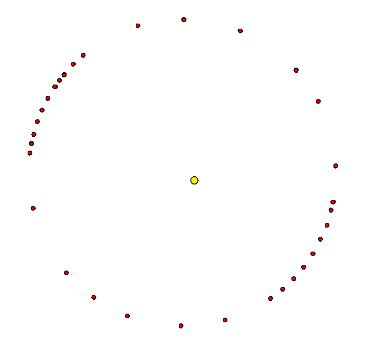
Data from the table below are graphed here. The data come in pairs and each pair corresponds to one point along Mars’ orbit. The first twelve entries in the table are plotted.
1. Zero degrees corresponds to the autumnal equinox. Earth’s orbit is approximated as circular. 2. First, the ecliptic longitude of Earth is marked, with the sun as origin. 3. Next, the elongation of Mars is marked with Earth as the origin. 4. Each pair of lines of elongation cross at a location of Mars. 5. Enough data should trace out the orbit of Mars. Once the data are plotted the elliptical nature of the orbit will be obvious; fit an ellipse with the sun at one focal point. 6. Only six positions of Mars are illustrated in this graph; color coded. 7. Thirty two positions of Mars are given in the table. Knock yourself out. |
|
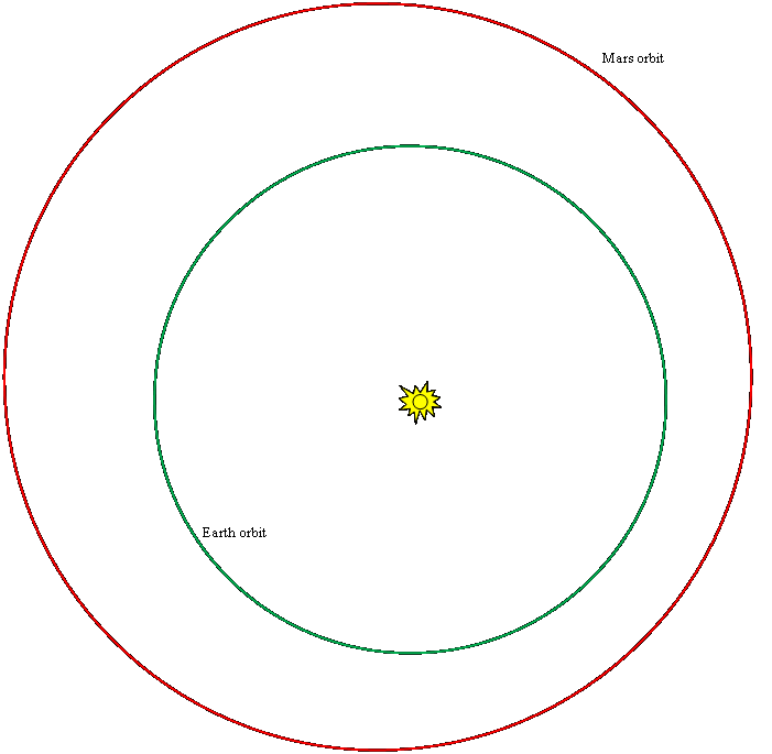
The planetary program from which the data above was taken. |
|
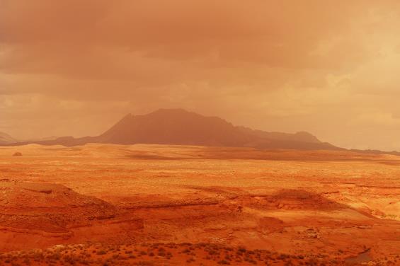
Mariner 9 image. Located near -80 degrees latitude and 64 degrees longitude, it is likely the result of wind deflation of deposits from underlying rough terrain. The "cells" in the image are about 4-5 kilometers in width.
http://nssdc.gsfc.nasa.gov/photo_gallery/photogallery-mars.html |
|
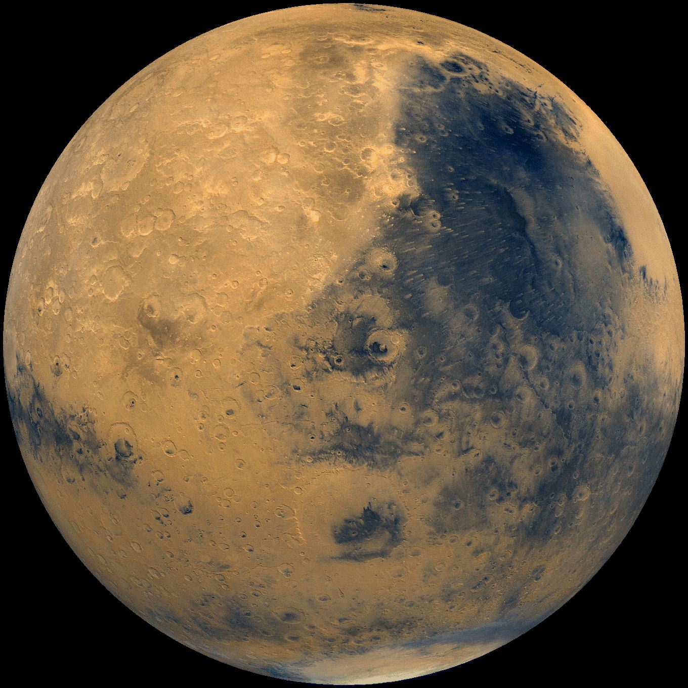
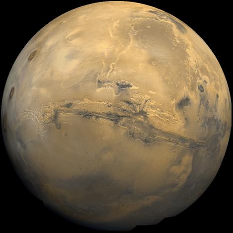
Color mosaic of Viking Orbiter 1 and 2 images showing Candor Chasma, part of the Valles Marineris system on Mars. This oblique view is looking from the north over the 800 km wide chasm, which is centered at about 6.5 S, 71. W. The walls and floor show evidence of erosion and mass wasting and complex geomorphology.
http://nssdc.gsfc.nasa.gov/imgcat/html/object_page/vom_nj05s070.html http://nssdc.gsfc.nasa.gov/imgcat/thumbnail_pages/mars_thumbnails.html |
|
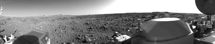
Mars - Viking 1 Lander
This is the first panoramic view ever returned from the surface of Mars. This view from Camera 2 on Viking 1 shows Chryse Planitia on 20 July 1976, shortly after Viking landed. The local time was late afternoon, the brightness on the right side of the frame is due ot the Sun to the west. The panorama covers 300 degrees. In the foreground are parts of the lander: the meteorology boom at extreme left, the housing for the sample arm, which has not been deployed yet, at left the cover for the radiothermal generator and at far left the high-gain dish antenna. Scattered rocks appear in the foreground center, ranging in size from about 10 to 20 cm across, and to the left and right can be seen areas of fine-grained material which are the edges of a small dune field. The features on the horizon are roughly 3 km away. The white band be seen in the center of the sky is not a cloud but simply a spurious reflection from the outer camera housing. The dark lines in the sky are a product of the imaging. http://nssdc.gsfc.nasa.gov/imgcat/html/object_page/vl1_p17045.html |
|
Photos: nasa
All links and photo references valid at time of writing and in future will likely never be checked to see if they are still valid. |
|
webpages and Eos image copyright 2020 M Nealon |

|
|
Date
new calendar |
Ecliptic longitude of Earth (degrees) |
Elongation of Mars (degrees) |
|
1 |
May 24 1589 |
242.881 |
142.838 East |
|
Apr 11 1591 |
200.758 |
115.126 West |
|
|
2 |
June 15 1591 |
263.505 |
175.806 West |
|
May 2 1593 |
222.238 |
93.553 West |
|
|
3 |
Sept 18 1593 |
355.838 |
163.05 East |
|
Aug 6 1595 |
313.632 |
96.196 West |
|
|
4 |
Nov 9 1595 |
47.055 |
179.291 West |
|
Sept 26 1597 |
3.634 |
94.173 West |
|
|
5 |
Jan 31 1598 |
131.16 |
132.513 East |
|
Dec 19 1599 |
86.825 |
128.375 West |
|
|
6 |
Feb 26 1600 |
157.298 |
142.577 East |
|
Jan 13 1602 |
113.25 |
122.009 West |
|
|
7 |
May 3 1602 |
222.738 |
111.952 East |
|
Mar 191604 |
180 |
155.067 West |
|
|
8 |
May 141604 |
233.578 |
135.376 East |
|
Apr 1 1606 |
191.26 |
122.870 West |
|
|
9 |
May 25 1606 |
243.473 |
179.334 East |
|
Apr 11 1608 |
201.36 |
95.872 West |
|
|
10 |
Aug 30 1608 |
337.042 |
149.133 East |
|
July 18 1610 |
295.175 |
100.734 West |
|
|
11 |
Oct 29 1608 |
36.211 |
107.238 East |
|
Sept 16 1610 |
353.061 |
139.849 West |
|
|
12 |
Jan 12 1613 |
112.29 |
136.184 East |
|
Nov 30 1614 |
67.93 |
122.951 West |
|
|
13 |
Oct 31 1578 |
47.485 |
137.773 East |
|
Sept 17 1580 |
4.053 |
111.781 West |
|
|
14 |
Mar 14 1583 |
173.046 |
108.558 East |
|
Jan 29 1585 |
129.287 |
163.082 West |
|
|
15 |
Feb 25 1587 |
158.67 |
154.648 West |
|
Jan 12 1589 |
112.915 |
88.994 West |
|
|
16 |
Feb 14 1585 |
145.978 |
173.876 East |
|
Jan 2 1587 |
101.775 |
103.153 West |
|
|
17 |
Feb 20 1585 |
152.013 |
165.574 East |
|
Jan 8 1587 |
107.892 |
107.466 West |
|
|
18 |
Mar 3 1585 |
163.037 |
151.146 East |
|
Jan 19 1587 |
119.091 |
116.079 West |
|
|
19 |
Mar 13 1585 |
173 |
139.321 East |
|
Jan 29 1587 |
129.243 |
124.843 West |
|
|
20 |
Mar 23 1585 |
182.904 |
128.852 East |
|
Feb 8 1587 |
139.368 |
134.692 West |
|
|
21 |
Apr 2 1585 |
192.756 |
119.644 East |
|
Feb 18 1587 |
149.45 |
145.757 West |
|
|
22 |
Apr 17 1585 |
207.423 |
107.854 East |
|
Mar 5 1587 |
164.479 |
164.583 West |
|
|
23 |
Mar 3 1583 |
162.597 |
116.665 East |
|
Jan 18 1585 |
118.633 |
149.381 West |
|
|
24 |
Dec 28 1595 |
96.202 |
125.423 East |
|
Nov 14 1597 |
51.936 |
129.588 West |
|
|
25 |
July 15 1591 |
292.135 |
147.998 East |
|
June 1 1593 |
250.601 |
104.238 West |
|
|
26 |
Aug 17 1591 |
323.764 |
119.972 East |
|
July 4 1593 |
282.081 |
120.361 West |
|
|
27 |
Sept 16 1591 |
352.89 |
103.873 East |
|
Aug 3 1593 |
310.743 |
142.905 West |
|
|
28 |
Sept 6 1591 |
343.131 |
108.577 East |
|
July 24 1593 |
301.165 |
134.189 West |
|
|
29 |
Aug 27 1591 |
333.426 |
113.881 East |
|
July 14 1593 |
291.615 |
126.751 West |
|
|
30 |
Sept 10 1576 |
357.001 |
118.264 East |
|
July 29 1578 |
314.752 |
120.801 West |
|
|
31 |
Sept 20 1576 |
6.84 |
112.689 East |
|
Aug 7 1578 |
324.377 |
127.959 West |
|
|
32 |
Sept 30 1576 |
16.738 |
107.709 East |
|
Aug 18 1578 |
334.039 |
136.402 West |